Overview
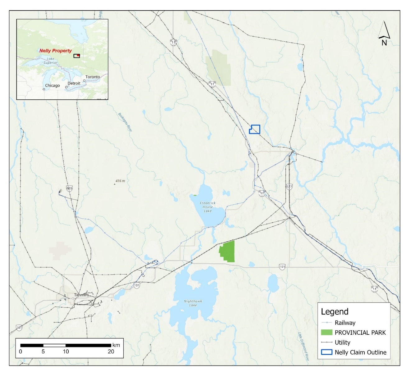
The Project is located northwest of the town of Iroquois Falls, Ontario. The Nellie Project comprises 18 contiguous cells within the Aurora township part of the Larder Lake Mining Division. The area is accessed from Big nellie Lake Road off Highway 11 near Iroquois Falls.
The project is located within the “clay belt” and while there are a network of logging roads most can do be driven except in the winter months or perhaps the driest part of summer. For drilling equipment these roads offer all year-round access to areas within the claim group winter months would require snow ploughing. Some areas are quite swampy and can only we access by foot.
Geology
The Nellie area lies within the Abitibi Sub-Province of the Southern Superior Province. The 2.75–2.67 Ga “granite-greenstone” dominated Abitibi Sub-Province extends some 700 km along the south-eastern edge of the Archaean Superior Craton. The volcanic stratigraphy of the Abitibi Sub-Province is divided into seven episodes or assemblages, based on similarity of age intervals, stratigraphy, and geochemistry.
The Nellie property is mapped as being underlain by Archean volcanic and ultramafic rocks which are intruded by felsic intrusives and (Matachewan) dolerite dykes. There are no outcrops on the eastern part of the project where the regolith consists of wet clay deposits.
Deposit Model Types
The project is prime for several different deposit model types that include: The Kambalda-type Ni-Cu-(PGE) ore deposits; bimodal mafic-ultramafic volcanic massive sulfide (VMS) deposit; and orogenic gold deposits are hosted by shear zones.
Project History
The project area has been explored several times over the past 70 years particularly for base metals immediately before and after the discovery of Kidd Creek Deposit. The following is a selection of observation and interpretations from old assessment reports which generally agree with the observations in the 2023 heli-magnetics survey.
The Canadian government sponsored surface geology investigations in 1961 and a 1000-foot aeromagnetic survey by Spartan Air Services Ltd. in 1963. A magnetometer survey was conducted by Shield Geophysics for in 1972. The 500-foot aeromagnetic survey revealed a prominent magnetic anomaly one half mile southeast of Cole Lake. Analysis yielded a depth estimate of 300 feet and a steep easterly dip. The survey also disclosed that this anomaly occurs at the edge of a large ultrabasic intrusion extending to the south and southwest. Susceptibility analysis of magnetic highs in the ultrabasic intrusion showed them to be significantly less magnetic than the Cole Lake anomaly.
The surface geology investigation confirmed that the area has granite volcanic contacts. A system of dikes confirms the existence of some structural weakness. The dikes were also collinear with the anomaly and the north striking feature mentioned before.
Geophysics
The 1000-foot aeromagnetic survey flight lines straddled the Cole Lake anomaly but indicated that it was on the edge of the ultrabasic intrusion. The survey extended further north than the previous one and better defined the feature north of the anomaly as a fault or dike filled fault. The ground magnetic survey establishes a more exact location of the Cole Lake anomaly. The center of the 3500-gamma anomaly shows a depth of 275 feet dipping steeply east. The depth and dip estimate and the location of the anomaly would agree with the possibility that the structural weakness could have provided the path for the emplacement of the magnetically anomalous material causing the anomaly. The survey also suggests that basic rock exists to the south of the anomaly, probably as part of the large ultrabasic intrusion further south, (Pekarik, 1974).
The magnetic anomaly defined by the ground survey was judged to be highly favorable and based on experiences in the Timmins region where the contacts between granites and volcanics on the edge of a large ultrabasic intrusion are structural weakness. It could be caused by a circular stock of highly magnetic basic rock or by nickeliferous.
Drilling
In 1995 Falconbridge drilled one hole (305m) on an EM anomaly in the northeast portion of the project intersecting ultramafic, mafic volcanics, sediments and then felsic intrusive rocks (no assays given).
One MDI record is shown as plotting on the project 42A15SW00043. The government website quotes drilling conducted in 2005 by A. Wilson, where the best assay returned 0.22% Ni over 5 ft from core. The best Cu value was 0.10% Cu over 1 ft.
Stay Informed
Sign up to receive our latest news releases from the Canada One Mining Corp. team.


